Ontario Faces Record Wildfire Season Amid Climate Challenges
📅 2 months ago
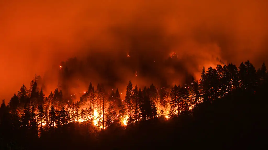
Ontario is experiencing its worst wildfire season on record, with over 7,250 square kilometers burned. The fires have prompted evacuations and raised concerns about climate change impacts.
OTTAWA — Northern Ontario is grappling with its most devastating wildfire season to date, as recent reports indicate that over 7,250 square kilometers of forest have been consumed by flames. This alarming figure eclipses the previous record established in 2021, showcasing the rapid escalation of fire activity in the region. The preliminary data suggests that the worst of the destruction has occurred within the past ten days, exacerbated by severe thunderstorms and a significant heat wave in the Thunder Bay area, where temperatures reached approximately 15 degrees higher than the seasonal average.Experts attribute the increasing severity and duration of wildfire seasons across Canada to climate change, which is primarily fueled by fossil fuel combustion. The fast-spreading fires in Ontario have led to the evacuation of more than a dozen communities, predominantly First Nation populations, and have filled the skies with hazardous smoke that extends beyond the province’s borders.
A particularly large fire, measuring 3,188 square kilometers, is burning north of Thunder Bay, contributing significantly to the total area affected. Although recent rainfall has somewhat mitigated fire activity in northern Ontario, officials remain cautious, indicating that the risk remains elevated. “There hasn’t been enough rain in the northwestern part (of Ontario) to really knock things down for the long term,” stated Liam Buchart, a fire weather specialist with the Canadian Forest Service.
Looking ahead to August, forecasts predict that much of northern Ontario could experience continued hotter and drier conditions. While the intensity of the weather may not reach the extremes seen recently, Buchart emphasized that “a complete reprieve is not really in the forecast.”
The preliminary estimates regarding the area burned are compiled by the province’s wildfire agency and are shared with the Canadian Interagency Forest Fire Centre, a non-profit organization that coordinates firefighting resources across the nation. Federal wildfire records, also known as the national burned area composite, have been maintained since 1972 and rely partially on high-resolution satellite imagery for data collection.
The dense smoke generated by the fires complicates efforts for officials to produce accurate real-time wildfire estimates. Eventually, satellite imagery will aid in identifying any unburned regions that may have been mistakenly included in the initial area-burned calculations. The situation remains critical as Ontario continues to navigate the ongoing challenges posed by this unprecedented wildfire season.
🏷️
emergency response
First Nations
wildfires
Ontario
climate change
Infrastructure
forest fires
construction safety
environmental impact
natural disasters
← Previous Post
Understanding Concrete Cylinder Break Machines and the Necessity of Destructive Testing2 months ago
Next Article →
AI Innovations in Municipalities Aim to Expedite Canada’s Homebuilding Process2 months ago