UBC's CanopyFit Program Aims to Optimize Urban Tree Planting for Climate Resilience
📅 4 days ago
A new tool developed by UBC researchers helps cities strategically plant trees to combat heat, with pilot programs in Kelowna and Vancouver aimed at enhancing urban forestry.
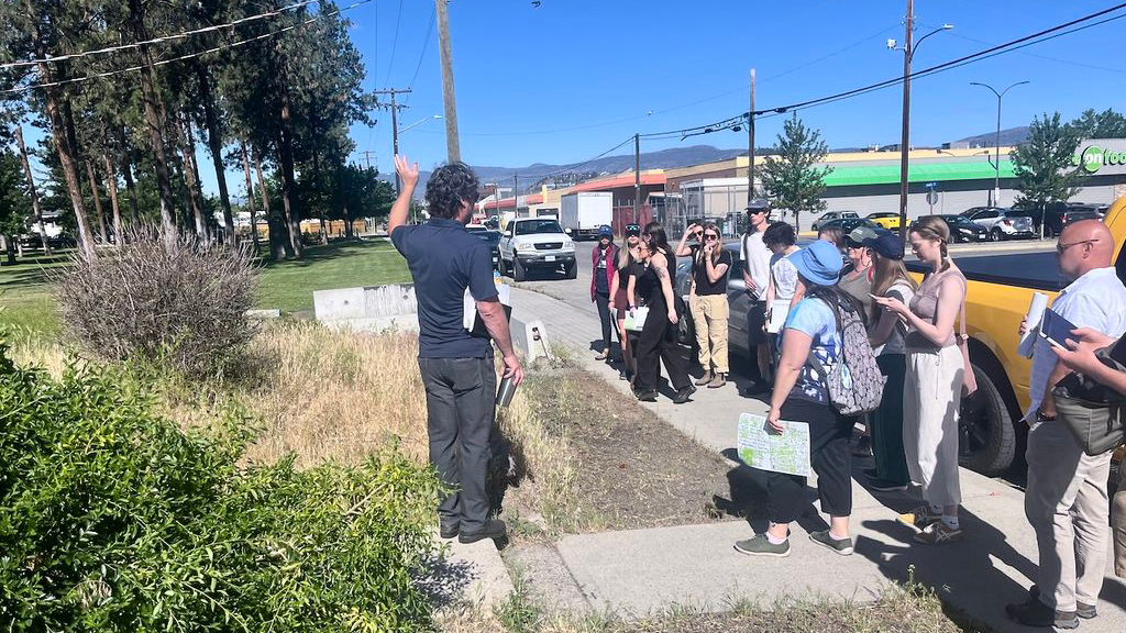
A research team from the University of British Columbia (UBC) has introduced a groundbreaking platform known as CanopyFit, designed to assist municipalities in identifying optimal locations for tree planting to enhance shade and mitigate radiant heat. Dr. Melissa McHale, a professor within UBC’s Faculty of Forestry and Environmental Stewardship and the lead developer of CanopyFit, emphasized the importance of maintaining and expanding urban canopy cover. "Creating and sustaining extensive canopy cover, by protecting mature trees and planting trees that can grow to large sizes, is one of the most effective investments cities can make to reduce exposure to extreme heat," she stated. As urban centers formulate strategies to develop their forests, a significant challenge lies in pinpointing suitable sites for tree growth that can effectively provide cooling benefits. "A site can look empty on a map and still be impossible to plant," noted McHale, highlighting the hidden barriers that can impede trees from reaching the heights necessary to provide cooling effects. Cities are understandably cautious about wasting financial resources on ineffective planting efforts.The CanopyFit program was initially piloted in Kelowna, where it is estimated that nearly 80,000 trees must be planted by the year 2050, with the collective efforts of residents, businesses, and developers aimed at addressing increasing temperatures. The program has since been adopted in Vancouver, where environmental firm Diamond Head Consulting is utilizing it within its spatial forecasting tools to assess canopy growth and inform urban planning initiatives. Vancouver has set an ambitious target of planting 100,000 trees by 2050, supported by a $7.5 million allocation for urban forestry within its 2023-2026 capital plan.
Before implementing CanopyFit, a consultation process is necessary to establish specific objectives and goals relevant to the proposed urban area, as these can vary significantly from one city to another. Additionally, the results may need to be adjusted according to budgetary limitations. The platform employs LiDAR and satellite data to gather information about the landscape and vegetation, including both treed and grassed areas across private and public lands within a municipality. Temperature data across the city is compiled to create heat maps, and in the case of Kelowna, the CanopyFit team employed satellite imagery and machine learning to enhance the city's heat map resolution from 30 meters to 10 meters. This refinement enables urban planners to accurately identify specific locations requiring cooling interventions.
Once the urban data is aggregated, including details about underground utilities, sidewalks, and local regulations, CanopyFit compiles this information onto a comprehensive urban map. This map identifies optimal planting sites for various tree species, taking into account factors such as pruning requirements, watering needs, and the presence of underground structures like parking areas. The model can also highlight critical hot spots that require mitigation efforts to improve local temperatures for residents. Analysis from the Kelowna pilot revealed that approximately half of the city’s new canopy potential is concentrated in about 20 percent of the high-value planting sites, indicating that cities can achieve significant benefits through strategic planting and cooling interventions.
Dr. McHale emphasized that while the model provides valuable insights into where planting should occur, each urban program is unique. "The City of Vancouver and the City of Kelowna have different rules, trees, and development considerations, all of which matter," she remarked. Diamond Head Consulting was already engaged with Kelowna on developing an urban forest strategy when CanopyFit was introduced, leveraging existing data to enhance their efforts. The firm has also maintained a collaborative relationship with UBC’s forestry program. "We had crossed paths," shared Amelia Needoba, principal and senior urban forester at Diamond Head, regarding the mutual sharing of resources. This partnership has enabled the firm to integrate CanopyFit into its toolkit for working with Vancouver and other potential clients.
As Vancouver aims to increase its urban canopy from 25 percent to 30 percent by 2050, the Vancouver Parks Board voted in 2025 to revise its strategic urban forest proposal. The goal is to maximize the return on investment for both trees planted and funds utilized, ensuring that the right tree is planted in the right location. CanopyFit is adaptable for municipalities across Canada, and Diamond Head has established relationships with clients in numerous provinces. Todd Cashin, Kelowna’s urban forestry supervisor, noted that CanopyFit and collaboration with UBC researchers have significantly influenced the city’s planting strategies, contributing to long-term sustainability efforts. "These partnerships are incredibly valuable because they allow us to accomplish so much more together than we could on our own," he said. Cashin also pointed out that recent wildfires and extreme heat events have heightened public awareness regarding the role of urban forests in climate adaptation. "We’ve known about heat effects in desert-style communities like ours, but sharing that message is easier now," he concluded. For further reading, Dr. McHale’s research paper is accessible here.
🏷️
Vancouver
tree planting
sustainability
urban forestry
Urban planning
heat mitigation
LiDAR
Climate adaptation
CanopyFit
Kelowna
← Previous Post
Alberta, Saskatchewan, and Northwest Territories Forge Agreement to Advance Nuclear Energy Collaboration4 days ago